Oficina Técnica Geosoft, C.A.
Digital Cartography and Photogrammetry Solutions Company
We invite you to know a little more about us and what we can offer you!
Products and Services
Our products and services are oriented to the generation of cartography at any scale and from any sensor. We use drones for very high precision and resolution surveys and high resolution or medium resolution satellites for obtaining orthoimages, DSM and DEM models, cartographic maps, topographic plans and its derived products. We manufacture our own software tools so we also offer them as a solution economic for institutions and service companies that require it.
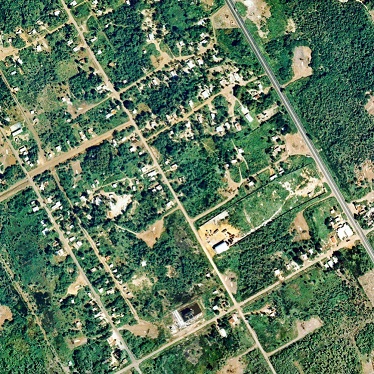
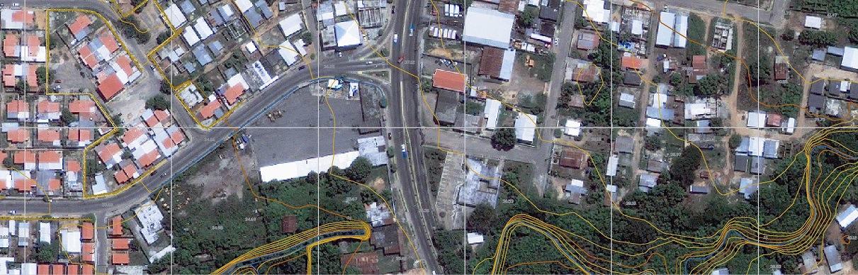
Orthoimage Generation
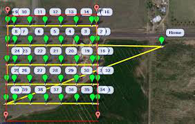
Aerial Photogrammetric Surveys with Drones
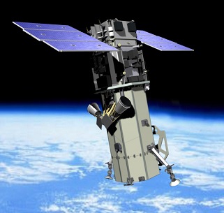
Satellite Photogrammetric Surveys
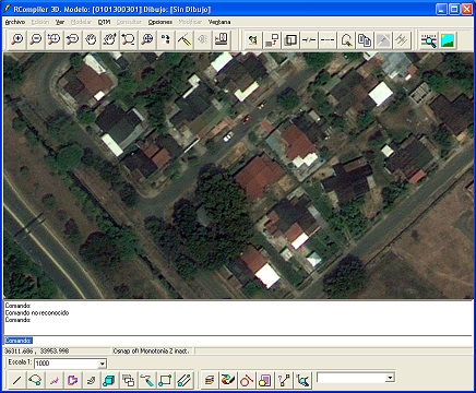
Softcopy Photogrammetry software
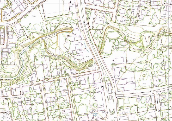
Products derived from the elevation model
Surface Models
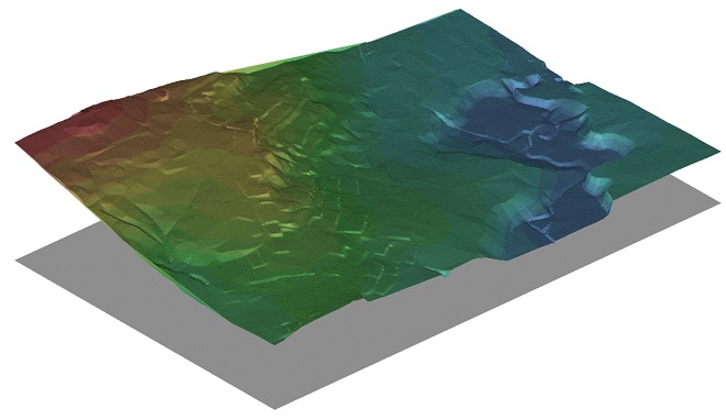
Elevation Models DEM,DTM
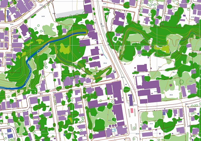
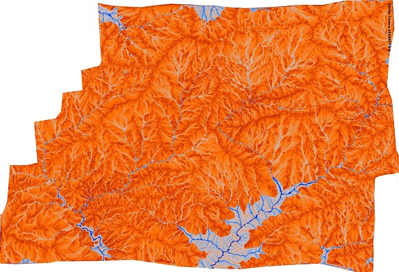
Thematic Maps
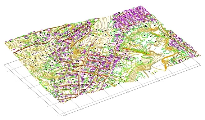
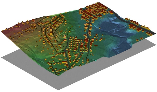
3D Topographic Maps
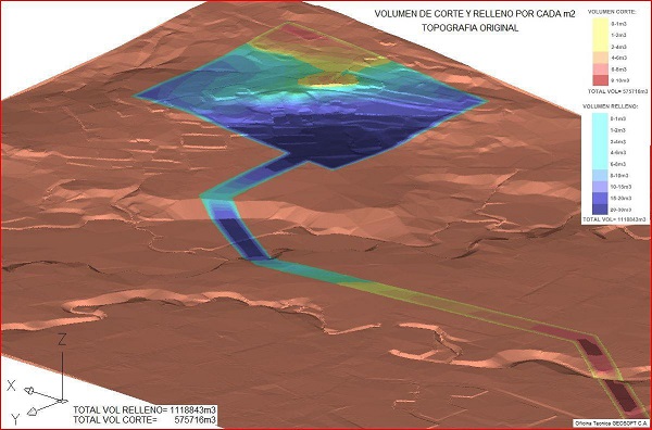
Volumetric Control
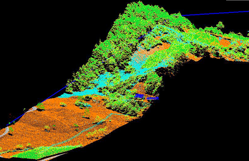
Lidar Surveys
About Us
OT Geosoft C.A. is founded in 1992 by two Venezuelan Engineers, Carlos Scala and Carlos Naranjo. Originally a service company associated with the oil industry OTGEOSOFT begins its operation by providing support services to exploration companies in the field, specifically in the topographic mapping areas, Geodesy, Development of seismic data processing among others. Shortly after, the company begins to diversify its spectrum of clients and services to include clients such as Electricity de Caracas, Corpoven, Lagoven, Maraven, Total Oil & Gas, Teikoku Oil, Edelca, Mobil, Conoco, British Petroleum, IGVSB, Planimara etc. among others. With these clients, more important projects of digitization were won and for that the first applications for the treatment of images was developed by us. In 1995 OTGEOSOFT began for the first time with the processing of images from aerial photographs in order to generate orthoimages. Here begins the DIGITAL PHOTOGRAMMETRY ERA of the company. First with small projects for gradually increase in size and complexity. OTGEOSOFT is the first Venezuelan company to perform processing of digital imaging and digital photogrammetry type "softcopy" using technology developed entirely "in house". To date we have a developed technology base internally that has allowed us to maintain leadership in our field compared to larger and older companies for many years. More recently we have expanded the technological offer to the use of high resolution remote sensors to do photogrammetry at multiple scales using a single stereo pair. We are currently developing technology to automate the generation of cartography using artificial intelligence and thus achieve the maximum possible productivity. We are committed to transform our organization toward an end to end AI based remote sensing information and solution generation provider.
Contacto
Address:
Venezuela
Calle Negrín,
Edificio Torre Alto Centro
Piso 12, Oficina 12C,
Sabana Grande 1050
Caracas, Distrito Capital,
Venezuela
Phone: +58-212-7617448 / +58-212-7618649
Mobile: +58-412-9029481 / +58-426-7143943
Panamá
Calle Sur 8-A, PH Costa Pacifica Torre 300, A-21D
Urb San Francisco
Corregimiento San Francisco
Ciudad de Panamá
República de Panamá
Phone: +507-203-5495
Mobile: +507-6686-8417